

Farmers always want to do the right thing and they want to continue on so that operation can go generation to generation. It all starts with agronomy and it has to be right for the operation and the field and that farm. We're not looking for flash in the pan one year commitments. We really want to make sure it's sustainable long term and it's good for that operation.
Casey Onstot | Marketing Leader
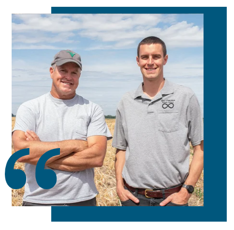
We can leave the soil better than we found it and we can make more money doing it.
Clint and Corbin Orr | Farmers, Father and Son-Indiana

We have had a longstanding attention to environmental stewardship because we know that our collective success depends on it. We’ve been waiting to be able to funnel money towards carbon neutral certification in a way that builds value for our farmers’ businesses. That wasn’t possible until Indigo Ag’s verification standard was approved. It gives us a market mechanism to drive revenue to farmers and helps all of us to succeed.
Katie Wallace | Chief Impact Officer

We need to do something different to develop a program that can be a one stop shop for all...relative to our value chain. And so we decided to streamline a program and...avoid duplicate work in many different formats. But most importantly for the growers, it was really about their experience, the ease of data collection, the speed of implementation, and I think what really landed us with Indigo Ag is the methodology.
Gregg Christensen | VP of Corn Milling
Agriculture plays a critical role in delivering climate solutions, and as Indigo has demonstrated, this work can be done with a high level of integrity. The Climate Action Reserve developed the Soil Enrichment Protocol to support and accelerate the adoption of agricultural practices that increase soil organic carbon and reduce greenhouse gas emissions, and we commend Indigo and farmers across the U.S. for their dedication to scaling sustainable agriculture to deliver real-world benefits for the climate. Indigo's achievement has also earned recognition for high integrity through ICVCM's CCP label, and the Reserve is proud to issue the market's first sustainable agriculture credits with the CCP label.
McKenzie Smith | Associate Director of Strategic Implementation, Climate Action Reserve